DEVELOPMENT
|
|
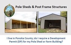
Before constructing a home, garage, shop and/or any accessory building(s) on your property, you must apply for a Ponoka County Development Permit. Upon receipt of your approved Development Permit you apply for all subsequent relevant permits from Superior Safety Codes Inc. (Red Deer).
Superior Safety conducts inspections throughout the construction process; they work closely with Ponoka County to ensure developments meet building codes and regulations. Permitting requirements and possible exemptions are highlighted in the Ponoka County Pole Sheds & Post Frame Structures literature below: |
Superior Safety Codes
Permit Applications: You MUST have a Ponoka County Development Permit in place prior to applying for the following:
|
PUBLIC HEARINGS
Rezoning Hearings
New hearings are posted on the home page
Subdivision & Development Appeal Board Hearings
New hearings are posted on the home page
DEVELOPMENT REPORTS
(includes Development Permits issued)
Subdivision
Subdividing is a multi-step process, the Subdivision Guide answers common questions and includes timeline and fee information. If you require further clarification please contact the administration office at your convenience 403.783.3333 or subdivisions@ponokacounty.com
Support Documents:
Support Documents:
Area Structure Plans (ASP) |
Development Plans |
Intermunicipal Development Plans (IDP) |
|
Morningside Area Outline Plan
1985 Outline Plan West of Highway #2 ASP [from Hwy #604 to north of Hwy #53] Adopted May 18, 2018 Morningside ASP Adopted October 9, 2018 North-West Ponoka ASP Adopted October 25, 2018 Menaik Road & QE2 ASP Adopted January 26, 2021 |
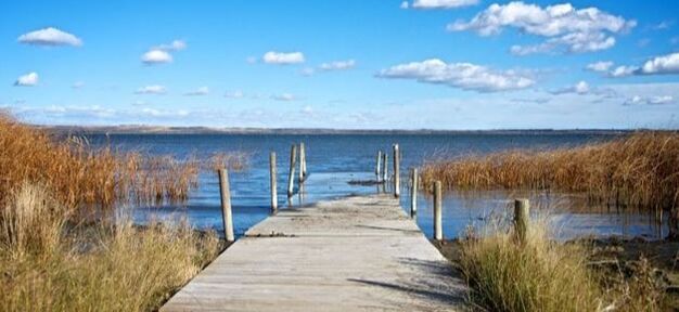
East Gull Lake Overview Plan
October 13, 2009 West Gull Lake Overview Plan June 2010 Chain Lakes Watershed Management Plan September 13, 2012 Commercial & Industrial Development Hwy #2 Corridor May 13, 2014 Municipal Development Plan September 2023 |
Gull Lake IDP
December 2019 Town of Rimbey IDP April 2019 Summer Village of Parkland Beach IDP June 2018 Lacombe County IDP January 2020 Town of Ponoka IDP May 2021 |
Water Studies

|
|
|
Ponoka County
Gull Lake Area
Chain Lakes Area
Battle River Watershed Alliance (BRWSA)
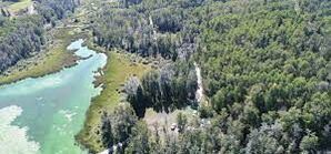
Ponoka County is a member of the Battle River Watershed Alliance. The BRWSA website provides online resource maps and data to the public. In addition they provide information relevant to planning and development with specific research data on water drainage on lands in our region. The Battle River Watershed covers much of our County area and is not limited to the banks of the Battle River.
Gull Lake Area
- Gull Lake Groundwater Monitoring Report [2022-23]
- Gull Lake Groundwater Monitoring Report [2020]
- Gull Lake Groundwater Monitoring Report [2018]
- Gull Lake Groundwater Monitoring Report [2016]
- Gull Lake West Study [2010]
- Gull Lake East Study [2009]
Chain Lakes Area
- Chain Lakes Groundwater Monitoring Report [2020]
- Chain Lakes Groundwater Monitoring Report [2019]
- Riparian Health Summary Final Report [2015] *for water analysis detail visit the Alberta Lake Management Society website.
Battle River Watershed Alliance (BRWSA)
Ponoka County is a member of the Battle River Watershed Alliance. The BRWSA website provides online resource maps and data to the public. In addition they provide information relevant to planning and development with specific research data on water drainage on lands in our region. The Battle River Watershed covers much of our County area and is not limited to the banks of the Battle River.
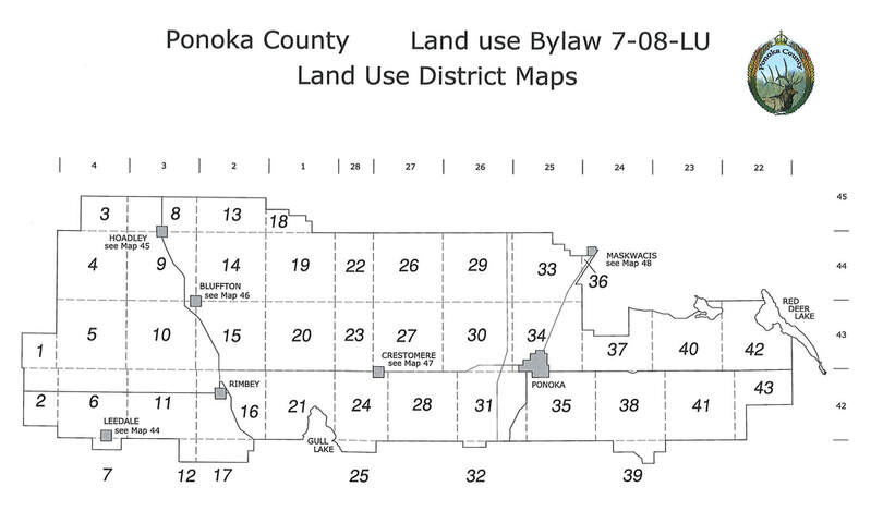
Zoning [Land Use Districts]
Zoning Maps
The maps are updated when changes are made to the Land Use By-Law and quarterly as new subdivisions are registered. Use your legal land location and the legend map below to determine where your property is located. * Land(s) not specifically labeled with a zoning code remain Agricultural (AG).
The maps are updated when changes are made to the Land Use By-Law and quarterly as new subdivisions are registered. Use your legal land location and the legend map below to determine where your property is located. * Land(s) not specifically labeled with a zoning code remain Agricultural (AG).
Rezoning
Under the guidance of the Municipal Development Plan (MDP) County Council will approve the rezoning of land for multi-lot residential subdivision only if, in the opinion of Council, the following conditions are met:
- The soil quality is poor.
- The subdivision will not interfere with nearby farming operations.
- The land is suitable for proposed use, using the criteria set out in Section 7 of the Provincial Subdivision and Development Regulations and Section 2 of Schedule "A" of the County's land use by-law.
- Alberta Transportation has indicated, in writing, that they have no objection to the development. This applies only where the land is within one mile of a numbered highway.
- The land is accessible from the nearest highway by a road which meets current County standards, or the developer is prepared to upgrade the road to these standards.
- Where there will be more than five lots on a quarter section, the owner has supplied proof of water supply, using the criteria set out in Section 23 of the Water Act.
- On land within one mile of Ponoka or Rimbey, the Town Council has no objection.
- There is no conflict with Provincial policies.